White County Public Safety has issued the following weather briefing summary:
ALL EMERGENCY SUPPORT FUNCTIONS ARE NOW ON ALERT FOR POSSIBLE ACTIVATION. All departments review and enhance your prepardness efforts for this significant weather potential.
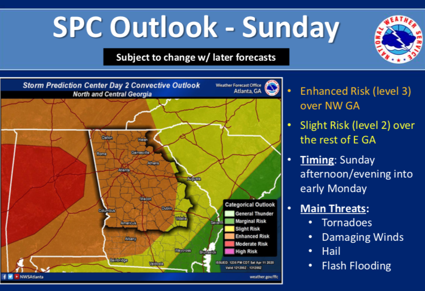
A severe weather outbreak is likely for the SE United States Sunday into early Monday. This system has the potential for being in the top five (5) most severe in the last 10 years. Comparing to the last 15 events of similar nature, this storm system is likely to produce damaging winds, tornadoes, heavy rain with potential flooding, and significant hail.
All risk categories, with the exception of hail, have increased and could likely increase further east as the system develops in the next 24 hours.
All of NORTH and CENTRAL Georgia will be in the higher risks categories. Likely starting Sunday afternoon, and lasting through the night, into Monday.
Confidence for damaging winds and tornadoes is a four (4) out of five (5), and the confidence level is now four (4) out of five (5).
This storm system requires all of us to pay attention to weather events as they develop, monitor states to our west and prepare for the storm to move over our area.
All departments, both city and county need to review your emergency plans, and prepare to respond and activate your systems. Off duty personnel are subject to recall, be on alert.